Walk from Garn Fawr to Strumblehead

Our friend Paul was renting a small cottage in Trefin on the Pembrokeshire coast this week with the intention of  doing some walks and taking some photographs for a story he was hoping to do, so we decided to go and help him. Paul used to work together with John  doing wedding photography. Paul continues the business, now that John has retired, at www.wessexweddings.co.uk

We met Paul and his dog Ben at the cottage in Trefin and started the walk at Garn Fawr a short drive away. Garn Fawr is an Iron Age hillfort situated on a craggy outcrop of the west end of the Pen-caer ridge. It is a short walk up to the summit of this craggy outcrop from which there are superb views over the bay to Strumble Head and Pwllderi. From there it is a rocky steepish descent down to the coastal path. Paul had to be careful because Ben always had to be in the lead and was upset when he wasn’t. We soon passed a brick building, one of an aligned pair, which were used for carrying out tests on  low level air to surface vessel radar. The other building, located at Strumble Head is now used as a bird observatory. Apparently there are also the remains of a two man coast watchers hut from the first world war.

The walk towards Strumble Head was very pleasant weaving in and out of little hillocks and a mixture of gorse and heather. From the cliff edges we could see Choughs doing their aerobatic display and hear seals on the rocky islets. We even saw House Martins which must have just arrived from their long journey from Africa. There are several rocky  inlets and small bays along this route one in particular, Porth Maenmelyn caught our attention. This is a small wild cove with steps cut into the cliff face apparently cut, about a hundred years ago, by an engineer working on the construction of Fishguard harbour and wanted his own private access to this cove.

Strumble Head
Circular walk at Strumble Head

To  open this walk in Google Earth click here.

After passing the light house at Strumble Head we continued further along the coast path until we reached a white holiday cottage owned by the National Trust where we turned inland. We followed bridleways which, considering how drive the weather had been, were quite muddy because they had been churned up by the horses. Probably this is not a walk we would do in the winter. We passed the smaller iron age fort of Garn Fechan on the way back to the car park at Garn Fawr.

lighthouse at Strumble Head
The Lighthouse at Strumble Head

After finishing the walk we drove back to Traeth Llyfn where John took some sunset photographs on the beach. As dusk fell on a perfect day we walked back to the Sloop Inn in Porthgain for something to eat before driving home.

Sunset
Sunset at Traeth Llyfn © John Burton
Share

Working on the Land

Since arriving here in Carmarthenshire last November we’ve been taking our time to decide what to do with things. We do not plan to actively farm our smallholding but to get the land back into shape before perhaps letting the pasture for sheep, creating some more woodland and harvesting the wood from our established woodland.

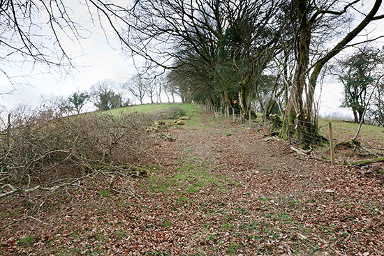
hedge
The Newly Cut Back Boundary and Repaired Fence

During January and February John spent some time with our adjoining neighbour cutting back the overgrown branches and mending the fences as the existing posts were breaking off. During March we have had such a long spell of dry warm weather that we started cutting up the timber and burning the brash.

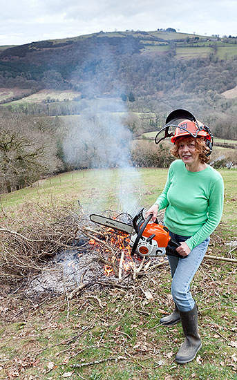
chainsaw
Liz 'poses' with the Chainsaw (Wot no protective trousers or gloves?)
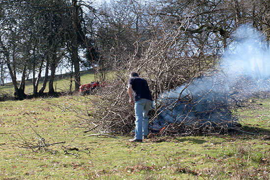
fire
John Gets the Fire Going (eventually!)

We did get quite distracted watching the Buzzards and Red Kites circling above us in the valley.

house
Our House Down in the Valley Below
Share

Circular Walk to Barafundle Bay Near Stackpole

Barafundle
Circular Walk Barafundle Bay

To open this walk in Google Earth click here.

We decided to explore more of the coast so drove down to the Stackpole estate owned by the National Trust on the Pembrokeshire coast, between the villages of Stackpole and Bosherton. We started our walk at Stackpole quay, a delightful little bay now used by fishermen and pleasure boats. There you can find tea rooms and toilets. We then walked along the coastal path to Barafundle bay. This walk takes you along high cliffs which are a haven for seabirds and occasionally choughs can also be seen here.

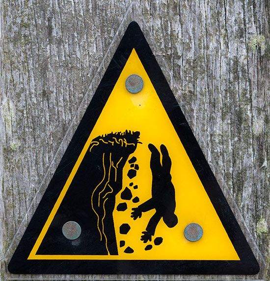
danger sign
Perhaps a tad dramatic!

Barafundle Bay has the reputation of being one of the best beaches in the UK. To be honest we thought it pleasant enough but not fantastic – but then we are not ‘beach people’. It is accessed from the path by some steepish steps and is  certainly very sheltered and has beautiful sands.

Barafundle
Barafundle Bay

The exit from the beach is up some more steps through a lovely wooded area.

Trees
Trees at Barafundle Bay (John's photography goes 'arty farty')

The walk continued along the cliff edge to Broadhaven beach where we turned inland to Bosherton Lakes, also known as the Lily Ponds locally. To reach these lakes we walked across the Stackpole Warren Dunes. These lakes were created by the Earls of Cawdor between 1780 and 1860. The lakes occupy 3 narrow valleys which were carved out by glacial meltwater in the carboniferous limestone of the area. They are important for the wildlife found there which includes otters, bats, birds and many wild flowers. It is also an important Stonewort area. Stoneworts are a type of green algae occurring in freshwater and may become calcified. Many British Stonewort species are under threat due to water pollution as they are very sensitive to nitrates and phosphates.

Spring Flowers
Spring Flowers by the Lily Ponds

It is a beautiful area to walk around the lakes passing through many wooded areas.  The walk back to the car park was across farmland and we went past the site of a standing stone but were unable to see it as it was hidden by a wood.

Back at the car park we had tea coffee and cake in the tea rooms (pretty rock and roll huh?) before heading home.

Share

A Walk From Porthgain to Abereiddi on The Pembrokeshire Coast Path

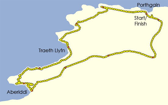
Porthgain walk
Circular Walk from Porthgain

Yesterday was one of the nicest days we have had for a while so we decided to go for a walk choosing a coastal walk because of the possibility of mist in the mountains.

To open this walk in Google Earth click here

This walk is slightly further north on the coastal path than the previous one and is about 45 miles from our house. Porthgain is a pretty village that was once a granite quarrying area and industrial harbour in the early 1900s. At the beginning of the walk we walked past the brick hoppers on the south side of the harbour and climbed some steep steps at the side of white building to reach the coastal path. The brick hoppers were used to store crushed granite before it was shipped. There are many ruined quarry buildings to explore at the start of the walk.

beach
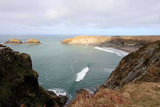
Another view of Traeth Llyfn

We then continued along the path with the watch tower at Abereiddi in sight. Along this first section are high dramatic cliffs.

beach
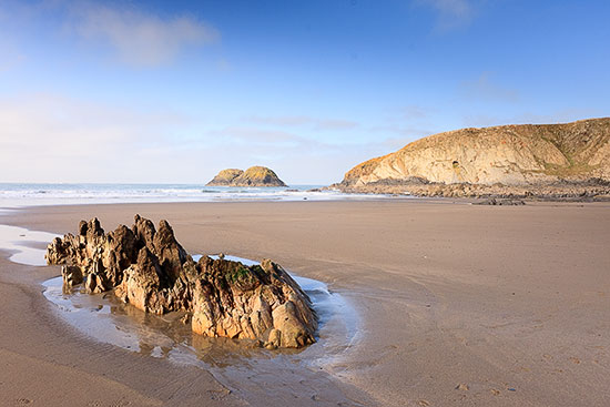
The Beach at Traeth Llyfn

We then came across the tiny beach at Traeth Llyfn which is reached by some steps. This is a stunningly beautiful remote beach with sand and rocks making it ideal for some photographs and a very pleasant lunch stop. There are very strong currents in the sea here and apparently it can also come in very quickly. It is a spectacular spot.

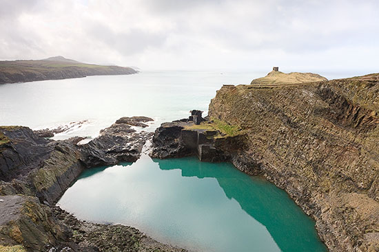
We then continued onto the Blue Lagoon (Ed. looks more green in my photo – John!) where there are very steep cliffs. The Blue Lagoon was formed from an abandoned slate quarry which was filled with seawater through a breach in the outer wall. This area is popular with coasteerers and divers. The beach at Abereiddi is accessed by a winding path. The is a large car park here and just inland  a group of houses built for the quarry workers but abandoned in the early 20th century after a flood. The ones that remain are presumably holiday cottages. There are ruins of old buildings around the Blue Lagoon. The rocks of Abereiddi bay are easily eroded Ordovician slates and apparently there are fossils of graptolites in the rock. We will have to have a look next time we go there.

blue lagoon
The Blue Lagoon

We made our way back to Porthgain by an inland route following the yellow footpath arrows. There is a lovely view of the valley up to Llanrhian which was carved by glacial melt-water during  the last ice age.

The total distance walked was 4.5 miles. We did not time ourselves as we had several stops for taking photographs.

Share

A Walk up Pen y Fan

Pen y Fan is the highest peak in the Southern UK at 886m.This walk was based around the info on the BBC Wales ‘Weatherman Walking‘ series. The walk described there is a slightly longer version of our walk.

To open this walk in Google Earth click here.

Pen y Fan Walk Map
Pen y Fan Map

We started the walk from the car park in Taf Fechan forest walking along the road for a short way and the along a track at the side of the forest. The track then gradually ascends  around Neuadd Reservoir towards Cribyn. After a while you have a choice of  ascending Cribyn or contouring around the side before starting up to the summit of Pen y Fan. The summit is marked with a stone cairn. Unfortunately it was surrounded in mist obscuring the views.

Pen y Fan from Cribyn
Pen y Fan

Then continue south west where again you have the option to go up to Corn Du before continuing in a south easterly direction along the ridge. Eventually after the reservoir there are two steep descents, we chose the second along side the wood. Note that this area can be boggy and the steep descent tricky in icy conditions as we discovered. We then followed the track back to the car parkWe were walking for about 4 hours including stops and covered 8.5 miles. Unfortunately we forgot to take a memory card for the camera so have used a royalty free photo!


Share

Tony Furtado at the Angel Inn Llandeilo

We drove off to LLandeilo on a bitterly cold night. This was a good concert in the upstairs room at the Angel, if it was a bit (Ed. very!) cold. Tony Furtado is an American banjo and slide guitar player, playing Americana, bluegrass and folk music. He has played with people such as Allison Krauss and Tim O’brien. I thought he was excellent in his own genre but was not too keen on the Irish tunes. He had 3 other people playing with him that night all good especially the two female vocalists. It was an enjoyable evening listening to a different genre of music.This concert was organised by the Llandeilo Acoustic club and they do have some good people playing in such a small town. Andy Irvine had played there in the past so we shall be keeping a lookout for what’s on.

Share

Martin Hayes and Dennis Cahill, London Irish Centre

Last night, a couple of days before moving to Wales, we went to London to see our heroes, Martin Hayes and Dennis Cahill in concert at the London Irish Centre Camden. What can I say? Words do not do justice to these two remarkable musicians. A fabulous concert as always.

They never disappoint and are lovely people. Martin’s mum came over from Ireland for the concert and she always takes the time to come and say hello to us and ask how we are.

Martin Hayes and Dennis Cahill – Taken at Feakle Festival 2010 by John
Share